Join 500K+ Users Who Fixed Their Signal in Stamps
Compare coverage from all major carriers and find the strongest signal areas in Stamps in under 30 seconds.
✓ Rated 4.8★ by 50K Users ✓ Works Offline ✓ Free Download

Find the best cell tower coverage in Stamps, Arkansas. Whether you're experiencing dropped calls, slow data, or weak signal strength, our comprehensive coverage maps help you locate nearby cell towers and find areas with the strongest mobile reception.
Compare coverage from all major carriers and find the strongest signal areas in Stamps in under 30 seconds.
✓ Rated 4.8★ by 50K Users ✓ Works Offline ✓ Free Download
Select a carrier below to view detailed coverage maps and tower locations in Stamps:
View AT&T cell towers and coverage areas in Stamps. Find the best signal strength locations.
View Verizon cell towers and coverage areas in Stamps. Find the best signal strength locations.
View T-Mobile cell towers and coverage areas in Stamps. Find the best signal strength locations.
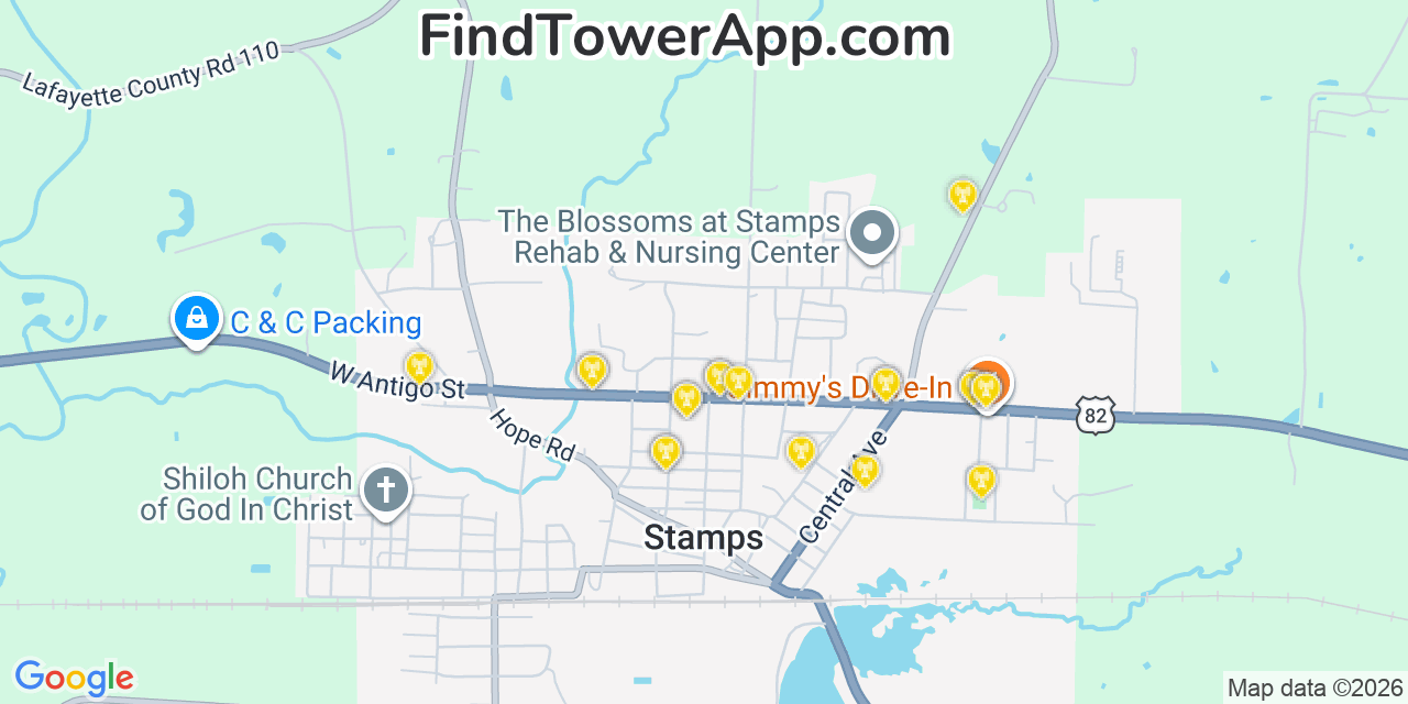
Our database maps 20 towers within range of Stamps, Arkansas (15 4G LTE, 4 3G, 1 5G), the closest 0.0 mi from the centre and 0.7 mi on average, out of roughly 288,354 towers across all networks in the wider area. The closest tower sits about 0.0 mi away, so most of Stamps, Arkansas should see strong signal outdoors and near windows indoors.
| # | Network | Type | Distance | Direction |
|---|---|---|---|---|
| 1 | AT&T | 5G | 0.0 mi | SW |
| 2 | Sprint | 4G LTE | 0.0 mi | W |
| 3 | Sprint | 4G LTE | 0.1 mi | W |
| 4 | Verizon | 4G LTE | 0.2 mi | SE |
| 5 | Verizon | 3G | 0.2 mi | SW |
| 6 | Verizon | 3G | 0.2 mi | SW |
| 7 | Verizon | 3G | 0.3 mi | E |
| 8 | Sprint | 4G LTE | 0.3 mi | W |
| 9 | AT&T | 4G LTE | 0.3 mi | SE |
| 10 | AT&T | 4G LTE | 0.3 mi | SE |
| 11 | Sprint | 4G LTE | 0.5 mi | E |
| 12 | Sprint | 4G LTE | 0.6 mi | E |
Tower positions are approximate, derived from public cell-ID observations; open the FindTower app for live signal at your location.
Join thousands of Arkansas residents who've improved their connectivity with FindTower.
✓ Free Download ✓ Works Offline ✓ All Arkansas Cities
Explore coverage maps for other cities near Stamps in Arkansas:
View cell tower coverage maps for Paragould
View cell tower coverage maps for Melbourne
View cell tower coverage maps for Charleston
View cell tower coverage maps for El Dorado
View cell tower coverage maps for Marianna